8th century BCE — present
Shakhrisabz and Kesh: from Sogdian centre to Timurid heritage
The story of Kesh spans early settlement, shifting urban sites in the Kashkadarya valley, Timur's building programme and the challenge of conserving an historic town.
- Earlier name
- Kesh, upper Kashkadarya region
- Landmarks
- Ak-Saray, Dorus Saodat, historic quarters
- UNESCO
- World Heritage since 2000; on the Danger List since 2016
Kesh in historical geography
Kesh occupied the upper Kashkadarya valley. Routes led north to Samarkand, west to Nakhshab—modern Karshi—and south through mountain passes towards Bactria. It was not an isolated “city of Timur” but a centre of southern Sogdiana. Its position explains links with other oases and changing political influence.
Pavel Lurje's account in Encyclopaedia Iranica places the Padaytak-tepe and Uzunkir archaeological complex near today's Shakhrisabz between the eighth century BCE and the Achaemenid period. This does not mean that the present street plan has remained unchanged since antiquity. The location of the main settlement shifted within the oasis.
Rulers and urban change
Kesh appears in accounts of Sogdiana and the Arab conquest. Local rulers negotiated between Arab armies, Turkic powers and neighbouring centres. Coins with Arabic legends and reports of revolts show that political and cultural transitions lasted decades rather than one year.
Samanid-era geographers described a town with citadel, inner city and suburbs. Some older settlements declined while new centres emerged. Thus “Kesh” may denote a region, a town or a relocated settlement in different texts; matching a written name to a particular archaeological site requires caution.
Timur's building programme
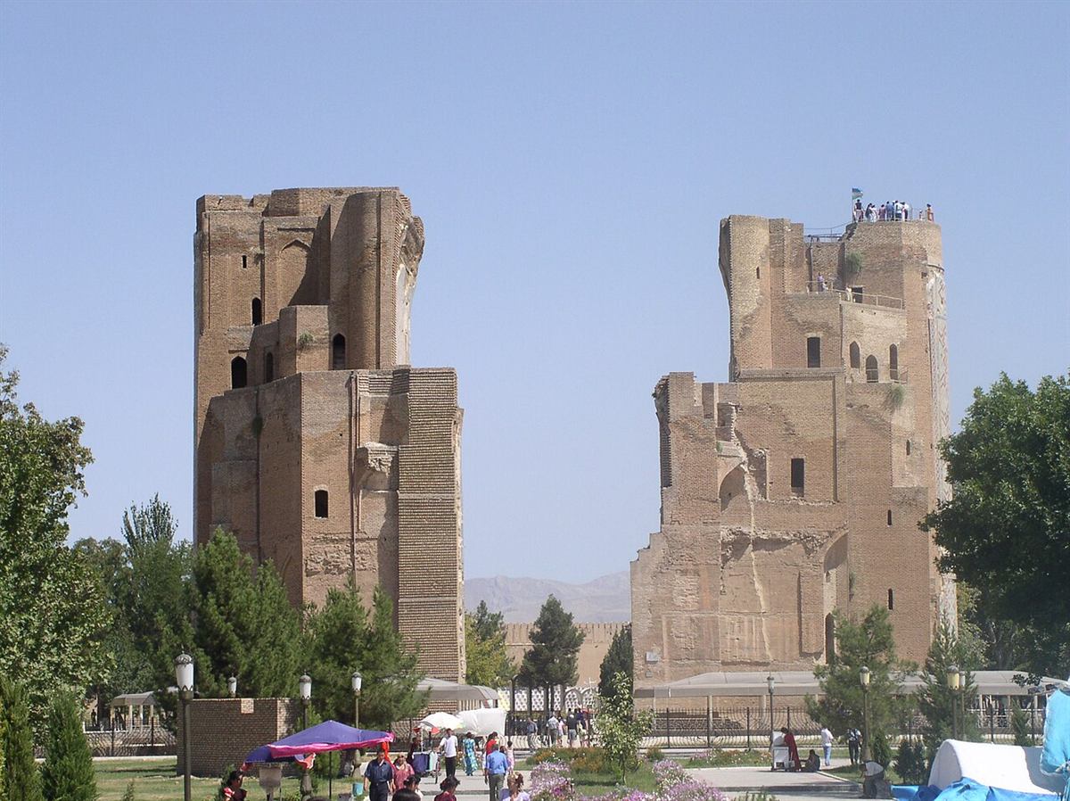
Timur came from the area and made Kesh a summer residence. Work on the Ak-Saray Palace began in 1380. UNESCO connects its rich decoration to craftspeople forcibly moved after the conquest of Khorezm. The building's scale cannot be separated from imperial policy and coercion.
Huge parts of the entrance portal survive, but not the whole palace. Dorus Saodat was intended for dynastic commemoration and burial. Together with mosques, the Chor-su bazaar, baths and residential quarters, these monuments show Shakhrisabz as a lived-in city rather than a collection of landmarks.
Conserving an historic city
The historic centre entered the World Heritage List in 2000. According to UNESCO, its value lay both in individual buildings and in the medieval street pattern and traditional houses. Repairing façades cannot compensate for the destruction of streets and neighbourhoods.
The property joined the List of World Heritage in Danger in 2016. The UNESCO Committee recorded severe, irreversible harm to the urban fabric from large-scale reconstruction, resident relocation and inappropriate conservation materials. Its 2026 decision retained this status. Older UNESCO descriptions praising the centre's integrity reflect the condition assessed at inscription and should not be mistaken for a current assessment.
