Palaeolithic — Early Iron Age
The earliest societies of Uzbekistan
The region’s history begins long before states and written records. Archaeology reconstructs it from soil layers, stone tools, bones, settlements and rock art.
- Geography
- Amu Darya, Syr Darya, Zarafshan and mountain foothills
- Key sites
- Teshik-Tash, Obi-Rakhmat, Anghilak, Kulbulak
- Methods
- Stratigraphy, radiocarbon analysis, archaeozoology
Geography and scope
Uzbekistan brings together mountains, foothills, river valleys, oases, steppe and desert. Pleistocene climates changed repeatedly, so the modern landscape cannot simply be projected into the distant past.
Modern state borders are only a geographic frame. Prehistoric cultures extended across the territories of today’s Central Asian states, Afghanistan and Iran.
How archaeologists establish age
Stratigraphy establishes a relative sequence of layers. Radiocarbon dating measures organic material, while luminescence methods help date minerals and sediments.
Tool and pottery typology provides relative chronology. The strongest conclusions emerge when several independent methods agree.
Teshik-Tash: find and interpretation
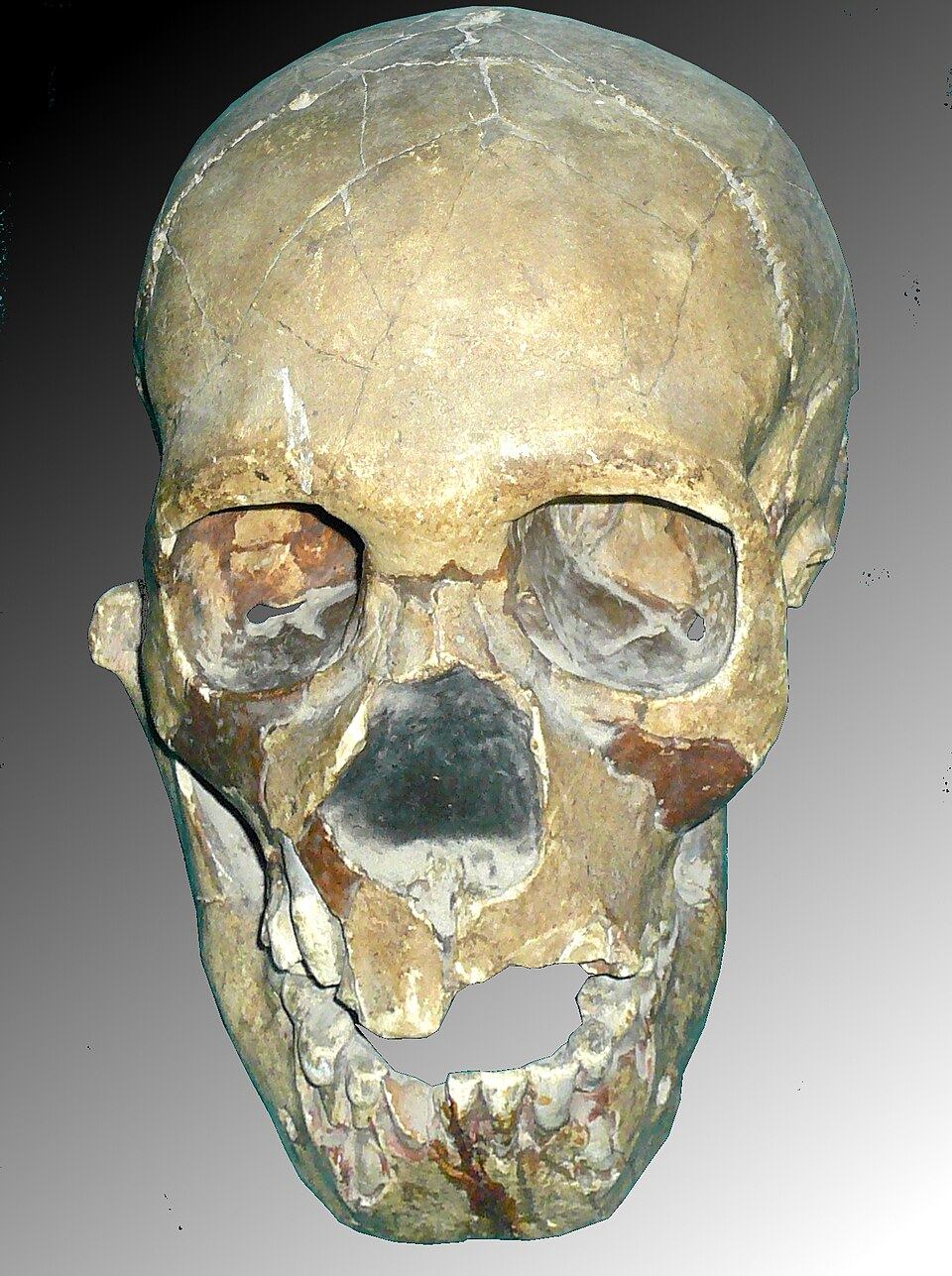
Teshik-Tash Cave in the Baysuntau mountains became famous after Alexey Okladnikov’s 1938 excavations. A child’s remains, traditionally identified as Neanderthal, were found with Middle Palaeolithic stone tools.
Ibex horns surrounding the remains inspired an interpretation as a ritual burial. The find and its context are facts; the deliberate arrangement and symbolic meaning remain debated.
Obi-Rakhmat, Anghilak and Kulbulak
Obi-Rakhmat’s multilayered deposits preserve stone industries, animal remains and evidence of repeated human visits. Cranial fragments and teeth from a young individual combine features that researchers have interpreted differently.
Radiocarbon, optically stimulated luminescence, uranium-series and electron spin resonance methods have all been applied to the site. Their differences show why a date should identify its sample, layer and uncertainty.
Anghilak expanded the known geography of Middle Palaeolithic sites. A human bone found there is not diagnostic enough for a confident species identification, making caution more accurate than a sensational label.
Kulbulak is an open-air site at the western foothills of the Tian Shan. New excavation and dating forced revisions to older schemes; the geology of its deposits matters as much as stone-tool typology.
The Mesolithic and rock art
After the Pleistocene, communities adapted to new Holocene conditions: animal populations, seasonal resources and uses of landscape changed. The evidence is uneven, so the transition from Palaeolithic to Neolithic cannot be reduced to one straight line.
Zarautsay in Surkhandarya preserves groups of images assigned to the Mesolithic, Neolithic, Bronze Age and later periods. It belongs to a wider cultural landscape in which farming and pastoral communities interacted.
Sarmishsay in Navoiy Region contains one of Central Asia’s largest concentrations of petroglyphs. Images of different periods share the landscape with settlements, burials and traces of ancient routes.
Proximity does not prove that images are contemporary. Researchers compare technique, patina, overlaps, animals, weapons and transport; many dates remain ranges rather than precise years.
Siypantosh in Kashkadarya differs from open rock surfaces: its paintings occur beneath shelters and in shallow cavities of the massif. UNESCO describes it as a rare and possibly very early Central Asian rock-art complex, but “possibly” matters—the date still requires archaeological context and independent methods.
The Neolithic: different paths to food production
Central Asia did not experience a single uniform Neolithic transition. Communities of the Jeitun tradition in the southern foothills combined early farming and herding, while Keltiminar groups near the lower Amu Darya relied more heavily on hunting, fishing and gathering.
The Keltiminar tradition is known from sites in ancient deltas and desert-steppe zones. Shifting Amu Darya channels and bodies of water affected settlement, making palaeogeography essential to the archaeological map.
Clay composition, temper, forming, firing and decoration let archaeologists compare pottery-making groups. Similar vessels, however, do not by themselves prove the migration of an entire people.
Food-producing practices spread at different rates according to water, landscape, exchange and local traditions. Hunting and gathering could remain important alongside farming.
Bronze and Early Iron Ages
During the Bronze Age, southern Central Asia formed part of networks of settled farming communities and long-distance exchange. Metallurgy, irrigation and specialised craft developed unevenly; lapis lazuli, carnelian, metals and technical knowledge connected Bactria with neighbouring regions.
Sapallitepa in the Surkhandarya oasis was a fortified and densely planned settlement with substantial craft evidence. Burials illuminate age, health and ritual, but differences in grave goods cannot simply be converted into a finished table of social classes.
Djarkutan was a larger centre with residential and production areas and an extensive necropolis. Monumental buildings inspired labels such as ‘city’ and ‘temple’, yet its exact political status remains a reconstruction without written documents.
The transition to the Early Iron Age was prolonged. In Central Asia it is often placed in the ninth to eighth centuries BCE, but regional sequences differ. Settlements, burials, pottery, metal and environmental evidence must separate secure dating from disputed ethnic interpretation.
Tilla Bulak in the Kugitang foothills adds a small rural settlement to the better-known major centres of the Sapalli culture. Its inhabitants cultivated barley and wheat, kept mainly sheep and goats, and used locally produced fine wheel-made pottery. The site shows that one archaeological culture contained settlements of different scales and functions.
Stone, bronze and wooden seals from Tilla Bulak attest to an established symbolic practice. Their presence does not by itself prove a state administration: the excavators found no secure evidence that sealing was used there for administrative control.
Sources
- UNESCO Digital Library — History of Civilizations of Central Asia, Vol. I (1992)
- Encyclopaedia Iranica — Excavations in Central Asia: prehistoric periods
- Cambridge Antiquity — New excavations at Kulbulak
- Cambridge Radiocarbon — Chronology of Obi-Rakhmat Grotto
- UNESCO World Heritage Centre — Sarmishsay petroglyphs
- UNESCO World Heritage Centre — Zarautsoy Rock Paintings
- Smithsonian Repository — The Paleolithic Child from Teshik-Tash Cave
- Encyclopaedia Iranica — Tilla Bulak, a Late Bronze Age site in southern Uzbekistan
- UNESCO World Heritage Centre — Siypantosh Rock Paintings
- TSUOS digital library — O‘zbekiston tarixi, 1-kitob, A. S. Sagdullayeva (2018), каталог